Understanding, measuring, and strengthening the resilience of a system in the face of a humanitarian crisis [looking for funding]
January 2021 - December 2030
Handicap International
This participatory research project, proposed in collaboration with Handicap International, aims to work on the understanding, measure and improvement of the resilience of societies. We propose an approach to understand systemic instabilities, focusing on the interactions between different components of a system. To enable this change of perspective, based not on the study of distinct sub-parts of the network but on the system as a whole, we propose to combine mathematical tools such as networks and risk analysis and assessment approaches.
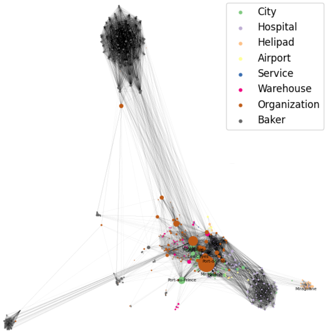
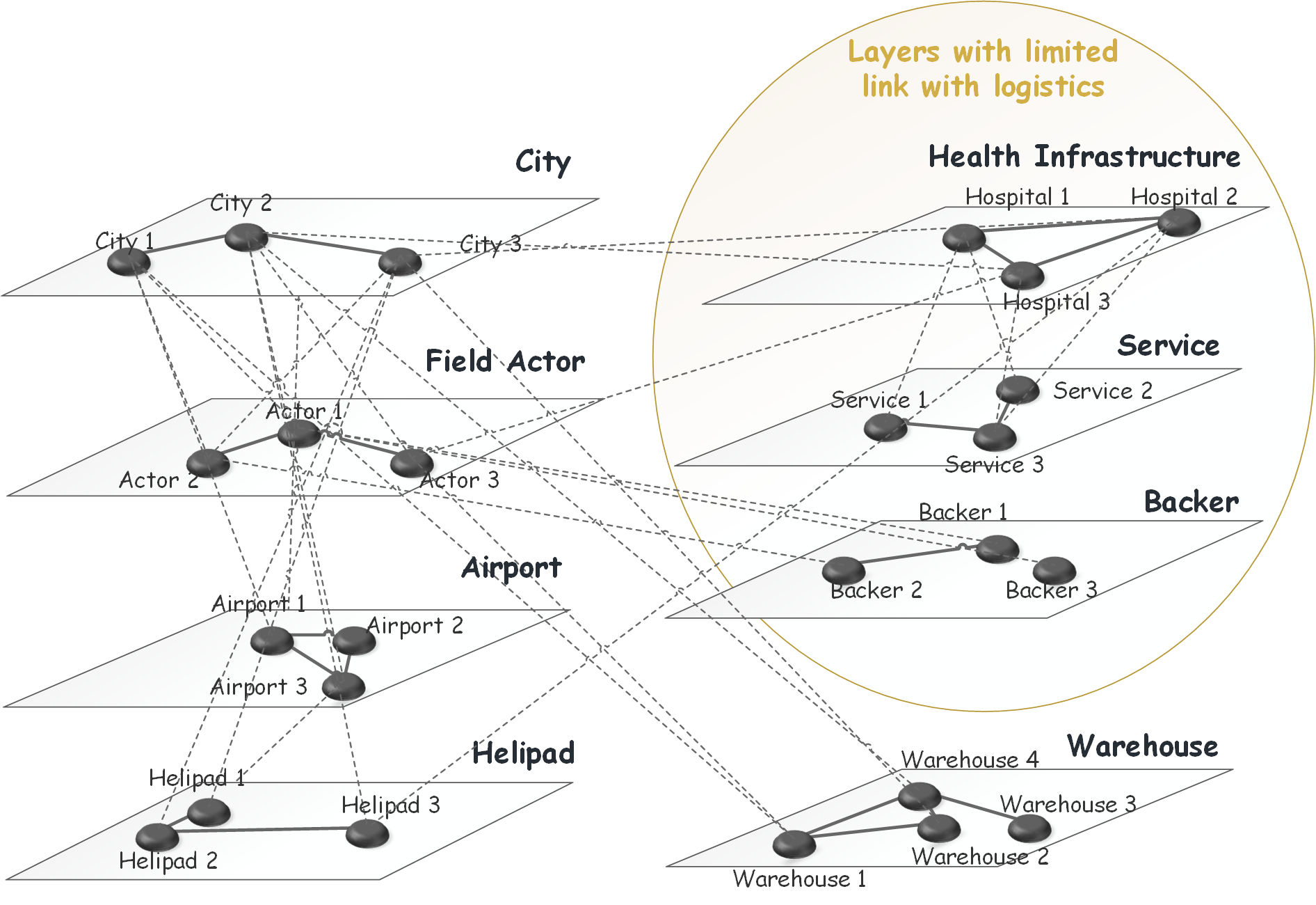
Firstly, we propose to model the environment (warehouses, airports, hospitals, schools, refugee camps, roads, etc.) and the interactions between the nodes of the system. This model will serve as a working basis for the following two stages. Secondly, we will work on measuring resilience by including the cascading failure mechanisms that can occur during crises. We will seek to prioritize the actions to be taken (rehabilitate a bridge or an airport for example) to mitigate the impacts of the crisis by maximizing the flows of products and people. Finally, we will seek to achieve greater efficiency in the allocation of available resources.
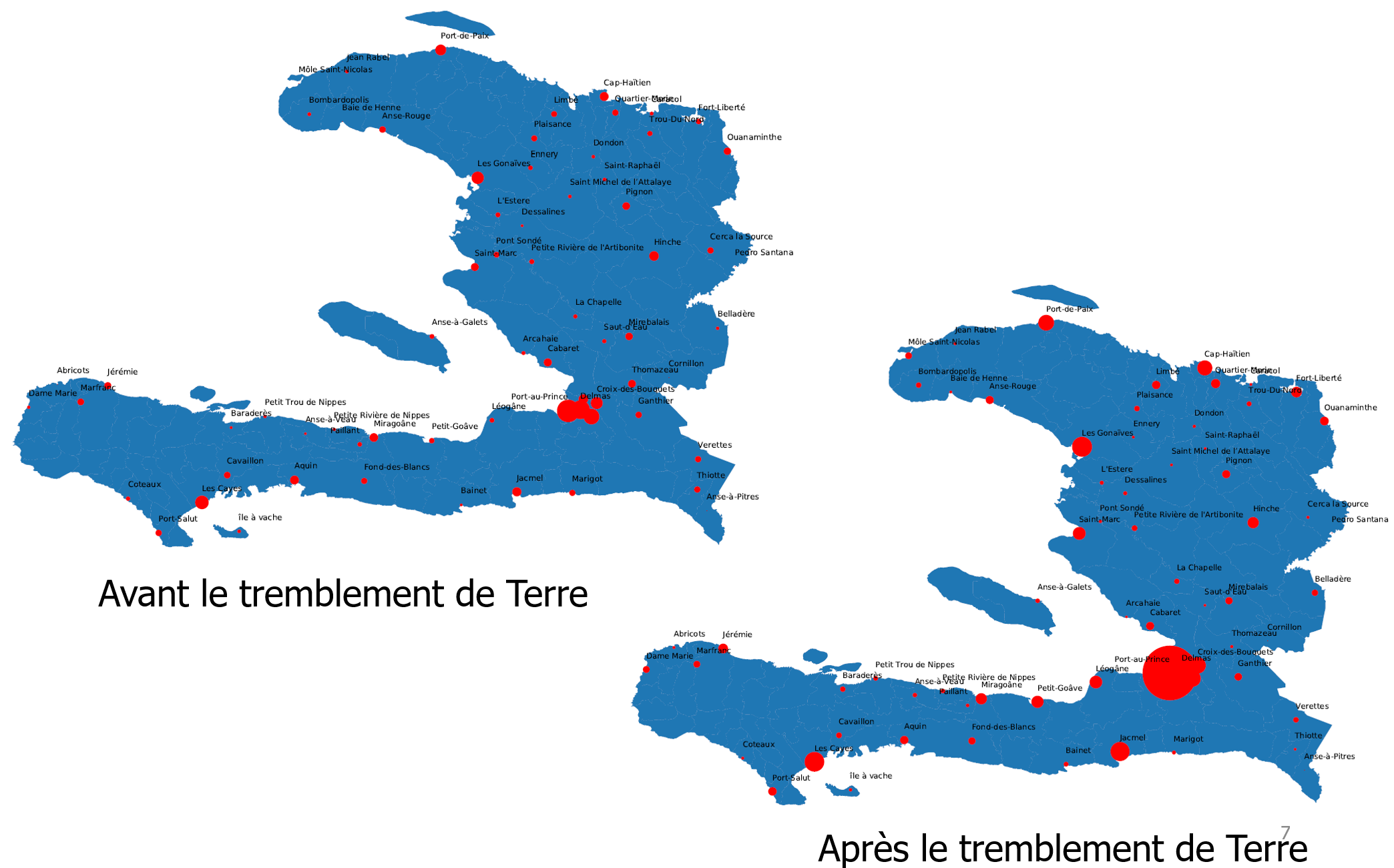
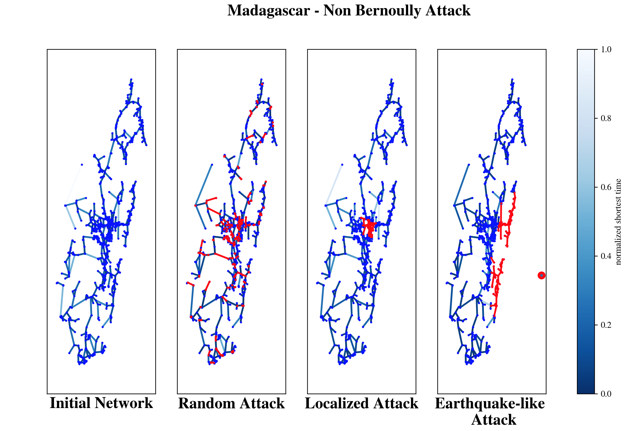
We will start by applying our approach to the case of Madagascar, where the regions of Diana and Boeny in particular are very vulnerable to natural crises such as cyclones and floods. Then we will look at a more complex case like that of Haiti or Mozambique, where the political, security and environmental context leads to major logistical challenges. Indeed, security constraints and the state of infrastructure in these areas, as well as the regular movements of affected populations, make effective planning and distribution of essential supplies difficult.
We are looking for funding on this projet! We have previous results on the subject, as shown in the figures below, and in the following articles and projects:
- Characterisation of the Robustness of Weighted Networks, a First Step to Better Understand the Context of Humanitarian Operations, Aurélie Charles, Guillaume Bouleux, Giacomo Kahn, French Regional Conference on Complex Systems 2023
- Understanding the situation at a glance: The powerful value added of complex networks to analyse humanitarian operations, Aurélie Charles, Guillaume Bouleux, Chantal Cherifi,International journal of disaster risk reduction 75, 102932
- A multi-layer network approach to model the situation before and after the occurrence of humanitarian crisis, Aurélie Charles, Chantal Cherifi, Guillaume Bouleux
- Modelling the complex system of the response to a natural disaster by a multilayer network approach, Chantal Cherifi, Aurélie Charles, Guillaume Bouleux,Conference on Complex Systems 2021
Projects: ANR ResHI (2025-2029)
Hereafter, you can feast your eyes on some figures from previous modeling and simulations.